April 18, 2022

Amber and Her Arborglyphs

M. and I were poking around in the Wet Mountains two days ago, at the site of a now-vanished picnic ground that I think dated from the 1920s creation of campgrounds and picnic grounds under the guidance of landscape architect Arthur Carhart.

Here he launched his vision of national forest recreation for people driving Model T Fords — as opposed to arriving by train at big resort hotels in national parks.

I wrote some posts about that, so if you want the history, go here.

This site, however, was apparently a victim of Reagan-era Forest Service budgets, where recreation was de-emphasized and the message to the San Isabel National Forest was "get the cut out," in other words, sell timber. Back then, there were more sawmills in the area. Now there are not.

When I started visiting the area in the early 1980s, my friends referred to the "[Blank] Picnic Ground" as a real place, even though there was nothing there but a capped-off well. 

But Amber, whoever she is or was, must have liked the place.

Amber came with Aaron . . .

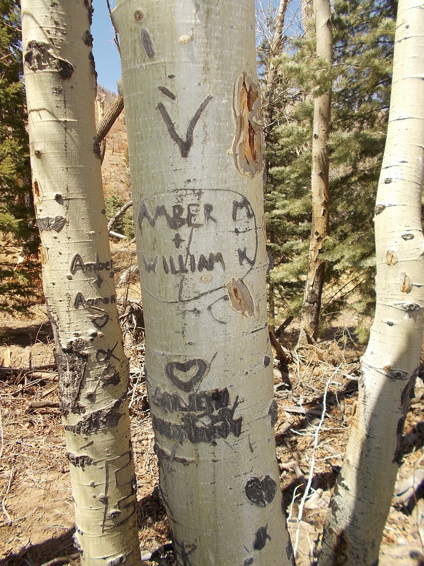
. . . and Amber came with William. I don't know the sequence.

Assuming it was the same Amber. I like to think so. The trees are barely a yard apart. 

The technical term is "arborglyphs." Quaking aspen is a good species for such carving. (If you do it now, it's vandalism, but if you did it a century ago, it is a historical record of American diversity.)

A lonely sheepherder mourns a lost love by carving a poem to her in aspen bark. A Cherokee man, forced from his home and leaving on the trail of tears buries his possessions at the foot of a tree, marking the tree so he can find it later. A young couple celebrate their love by carving their initials in a nearby sapling. The scars left in the bark of trees by these activities are called arborglyphs, literally "tree writing", and the study of these markings is revealing much about our history. . . .

Another common source of arborglyphs were the young Basque and Irish who immigrated to the United States in the early 1900s. Many went to work as sheepherders in remote mountain meadows, and carved poems, names, dates, faces and other images telling of their lonely, isolated lives into the Aspen trees. Some of the most famous Basque arborglyphs are found in Southern Oregon,

There is a digital archive of aspen carvings from southwestern Colorado, and also a book, Speaking Through the Aspens: Basque Tree Carvings in California and Nevada.

So does Amber count as "history" or "vandalism"?

April 13, 2022

A Big Burn Down by Bent's Old Fort

Fires everywhere in southern Colorado this week. I myself was "toned out" of bed at 2:27 a.m. yesterday, soon to be loaded into a brush truck (Type 6 engine) with three other volunteers, headed up the canyon as "mutual aid" to a grass fire running in front of 50 mph winds. 

A concentrated attack from three fire departments soon knocked it down, and after that we were just wet-lining and chasing flare-ups. 

The fire burned right up to the walls of the reconstructed trading post (National Park Service).

Meanwhile, down the Arkansas, two big fires blew up in southern Colorado, one around John Martin Reservoir and the other upstream at Bent's Fort.  This famous 1840s-1850s trading post was rebuilt on its original site in time for the 1976 American Bicentennial — now the reproduction has outlived the original. (And it has flush toilets).

Fire in cottonwood groves along the Arkansas River (La Junta Fire Dept.)

The Bent's Fort fire has burned more than 1,000 acres today.
  No threat to the fort really, and no homes lost in the area. 

“There is no threat to Bent Fort, it is being protected so I want that to be the main point. Mainly the fire has been in the river bottom, it has gotten out to some farm land but we’ve contained it off some farm land so its maintained to the river area,” [La Junta Fire] Chief Davidson said.

Funny thing, a fire like this probably would make the area around Bent's Fort look more like it did in its heyday, when the horses of trappers, traders, travelers, and visiting Cheyenne Indians no doubt nibbled all the grass and the riparian cottonwood groves were picked over for firewood. I have been told by Park Service staff that the wetland area east of the fort was not there in those days — it is a result of changing drainage patterns.

An old pole barn at Oxbow State Wildlife Area (Colorado Parks and Wildlife).
 

Across the river, much of the Oxbow State Wildife Area burned over too. It's a place where I once had a good duck hunt with my old dog Jack, and I was thinking of revisiting it with Marco this year. And maybe we will, just to see how it looks after a summer's regrowth.


Further down, another fire was burning around Fort Lyon and John Martin Reservoir. More old stomping grounds. 

The fire near Cheraw was contained Tuesday. (KOAA-TV)
 

It's time to become reacquainted with all that area, come September or October.


April 10, 2022

A Quick Video Trip through Colorado Geology


Colorado used to be south of the equator — about 300 million years ago. Things were a little different then: "a low-lying area, periodically inundated by the ocean." 

Since I live smack on top  of (not beside) the Fountain Formation, it is nice to see it get some attention. 

Also  I like the image of Colorado 9 through Summit County with glaciers on it.

A project of the Interactive Geology Project at CU-Boulder, which has its own YouTube channel.

April 04, 2022

Blog Stew: Who Has Enough Water to Cook It?


 • A new drought map.
January-March 2022 precipitation hit some record lows. I am relieved to be living in one of the green areas on the map.

 • If you grow up in a city grid, your navigational skills are not so good, says Science.

 • Navajo law enforcement jammed up by the "lure of outdoor recreation":

More people are visiting tribal lands throughout the West and adjacent public lands to hike, bike or boat, and they’re accompanied by concerns about trespassing and vandalism at cultural sites, as well as traffic accidents and other issues.