Showing posts with label Kansas. Show all posts

May 21, 2020

Lesser Prairie Chickens Reintroduced in SE Colorado

Some footage from Colorado Parks & Wildlife's ongoing efforts to re-establish lesser prairie chickens on the Comanche National Grassland in southeastern Colorado.

From the CPW news release:
CAMPO, Colo. – Lesser prairie chickens, gone for decades from the Colorado landscape, are again living on the eastern plains, thanks to an ambitious four-year project led by biologists from Colorado Parks and Wildlife, Kansas, the U.S. Forest Service, along with private landowners.

Recently completed surveys by CPW biologists revealed that hundreds of the birds are now thriving on breeding grounds, known as leks, on the plains extending across southeastern Colorado and western Kansas.

Lesser prairie chickens once numbered in the tens of thousands in those grasslands. But a variety of factors led to their gradual disappearance. Experts blame, in part, the conversion a century ago of grasslands to cropland that contributed to the Dust Bowl in 1932 and wiped out many of the birds. More recently, the lesser prairie chicken population in Southeast Colorado and Southwest Kansas was devastated by severe snowstorms, particularly in December 2006, followed by years of drought.

They even vanished on a 330,000-acre swath of sand sagebrush and grasslands known as the Comanche National Grassland in Baca County, Colo., and the Cimarron National Grassland in Morton County, Kan., as well as privately owned rangeland and Conservation Reserve Program grassland. . . .

By 2016, biologists counted just two males on the Comanche and five males on the Cimarron.

That same year, CPW decided to try relocating lesser prairie chickens from thriving breeding grounds in Kansas in hopes of resurrecting leks on the national grasslands. So a CPW team, led by conservation biologists Jonathan Reitz and Liza Rossi, began working in collaboration with the Kansas Department of Wildlife, Parks and Tourism, Kansas State University and the U.S. Forest Service. . . .

Over the past four years, the team of Colorado and Kansas biologists, and K-State graduate students, relocated 103 males and 102 females to the Comanche. The team also released 101 males and 105 females during the same time period just east of the state line 
Read the whole thing. 

Extra-credit question: What is the relationship between prairie chickens and contemporary pow-wow fancy dancing?

March 21, 2020

Vodka, Cherry Coke, and an SKS Rifle


All the worries these days. So here is James McMurtry's "Choctaw Bingo." You know who his daddy is, right?

I mainly like this song because aside from being drenched in Southern Plains au-then-ti-ci-ty, it is the only song that I know of that name-checks my mother's birthplace, Baxter Springs, Kansas. And bois d'arc/bowdark trees.

Of course, she was one of the good girls, and her grand-daddy was the postmaster, as long as there was a Democrat in the White House. She would be horrified.

The lyrics, if you need them, are here.  The Russian navy still uses SKS rifles for some parade units, without steel-cased Tula ammunition.

July 20, 2018

I Skipped National Grasslands Week — for a Reason


You probably missed this because you were watching migrating birds or something, but National Grasslands Week was June 18th-24th.

Or maybe you skipped it because the Comanche and Cimarron national grasslands are interesting country but it's just too damn hot there in June for recreation. Especially this year. (There are other national grasslands as well.)

I went to the Purgatory River dinosaur trackway that week in 2015, and while it was a good experience, I would much rather have gone in December. I have hunted in shirtsleeves on New Year's Day in southeastern Colorado.

January is also good, absent any blizzards. Or February. I used to take the nature-writing students out to Vogel Canyon (in the upper-left light-blue area on the map below) in early February.

It's a good entry point for the grasslands experience — all that aridity and melancholy and mysterious rock art.

It must have been someone sitting in an air-conditioned office who put National Grasslands Week in June. The bureaucratic mind at play.

March 30, 2018

Remember the Dust Bowl?


You probably don't remember it, unless you are over ninety. But see the right-hand blob of the red area? That's pretty much the center of the "Dirty Thirties." Compare it to this map.

December 29, 2015

Bear with Me — There's More

Bear enjoying late-season tomatoes.
More links that I need to clear . . . 

• "The Hermit: New Mexico's First Mountaineer" — it's a story of religion, violence, penitence, and isolation, in other words, New Mexico.

• Some birds do well in cities and suburbs. How can we help them?

• We are told the decades of forest-fire suppression has led to hotter, bigger files. But a CU study suggests that severe fires are not new on Colorado's Front Range.  

Plans to sequence the genome of the oldest dogs found in North America.

Outdoor magazine's best 25 books for well-read explorers. Old Glory, yes!

• Everyone hears about Coronado's expedition in the American southwest,  no one about Francisco Leyva de Bonilla's. Maybe that is because it was such as disaster.

• Saving a big piece of southeastern Colorado's canyon country. And a chunk of the High Plains east of Pueblo.

Why are we still talking about Chris "Supertramp" McCandless?
Twenty-three years after his death, McCandless still has people talking — debating his cause of death, condemning his choices and discussing how perhaps they, too, can leave everything behind and walk into the wild.
A "river of sheep" in northwestern Colorado. Good photos.

October 11, 2015

War and Groundwater

Someone once explained the 1967 Six-Day War, when Israel fought off Syria, Jordan, and Egypt and ended up controlling the Golan Heights, in terms of water.

By capturing the Golan Heights, the article asserted, the Israelis controlled the recharge area where precipitation filtered down to the wells watering their farms.

Western kid that I was, I thought, "Oh, I get it, it's all about water. No wonder the tanks are rolling."

Some students and I once kicked around alternative bioregional histories for southern Colorado. I suggested that if Kansas and Colorado were separate countries fighting over the Arkansas River's flow, we probably would have had a hard time stopping their troops. The citizens of Pueblo would have been digging trenches, like those of Warsaw in 1920. The border would probably be at Fowler now.

Fortunately, we have a judicial system which settled things, meaning that Coloradans do not have to say "Ar-KAN-sas" like those barbarians to the east. But I digress.

We all have heard about the California drought and the over-pumping of groundwater there. We should know that the same thing is happening on the High Plains (another argument for industrial hemp over thirsty corn).  Cities such as Santa Fe and Albuquerque, not to mention some Denver suburbs, depend on ground water—how long will that last?

What I did not know is that the Saudi Arabs have been playing the same game, and in about thirty or forty years they have drained an aquifer in the name of growing wheat. Saudi Arabia a wheat-exporting country? Who knew? Not me. But they are hitting the wall called No More Groundwater.

Just one more thing to stir up the Middle East. Over there, the tanks do roll.

January 05, 2015

Blog Stew Stored Underground

• Mysterious Kansas: Who built the stone caves and why? "Parish was wowed by the workmanship and created a panoramic image of it. Then he began to wonder: How many more of these are out there?"

New Mexico rock art panel (Western Digs).
• Datura — still legal in New Mexico (and everywhere else). Maybe there is a connection with ancient rock art: "Hallucinogenic plants were found growing beneath the triangle designs, including a particularly potent species of wild tobacco and the potentially deadly psychedelic known as datura."

• Maybe you have read that forest fires are bigger and hotter than in the past. Not if you take the long view, says a University of Colorado study.  "Wildfires along Colorado's Front Range, long assumed to be intensifying, may not be when understood in historical context before 20th-century firefighting, a new study finds."

May 15, 2014

Keeping the Southwest Chief in Southern Colorado, We Hope

Union Depot, Pueblo, Colorado. It's just offices now.
A small crowd gathered at Pueblo's Union Depot (which currently sees only freight trains pass by) on Wednesday, May 14th, to watch Gov. John Hickenlooper sign a bill that represented one step toward keeping Amtrak's Southwest Chief train running through western Kansas, southern Colorado, and northern New Mexico on its way between Chicago and Los Angeles.

First, Pueblo's favorite roots-music band, the Haunted Windchimes, played all the train songs in their repertoire as people gathered.

The Haunted Windchimes playing at the depot.
There were political operatives in tie-less blue button-down shirts and blue blazers, old rail-fan guys wearing train-themed caps, actual Amtrak employees, elected officials from the local, county, and state levels, and various people who unite in one idea, namely that train travel is local, comfortable, does not involve being probed by federal agents with blue gloves, and is environmentally sound.

In other words, when it comes to passengers moved per mile per gallon of fuel burned, trains beat everything else.

Why all the fuss? In essence, the Burlington Northern Santa Fe Railroad (BNSF) is not keeping up the tracks to the standard required for passenger trains. If they are not improved, Amtrak has threatened to reroute the Chief from Wichita-Amarillo-Albuquerque, cutting off western Kansas, southern Colorado, and northern New Mexico — areas that have poor air service and poor bus service.

Kansas has partnered with Amtrak and BNSF Railroad to help fund a portion of the track improvements required along the Southwest Chief route. If the track is not upgraded, Amtrak has warned that it may move its daily Chicago-to-Los Angeles passenger service to a more southern route.
Gov. Hickenlooper says a few words.

On the other hand, southern Colorado officials are more and more seeing an Amtrak route through Pueblo - Walsenburg - Trinidad, as compared to today's route from La Junta to Trinidad, which cuts off the I-25 corridor completely, as good for economic development and tourism.

Either way, M. and I want to keep the train running through southern Colorado, which is why we were there today, applauding with the crowd.

Airlines are increasingly abandoning mid-sized airports. Pueblo keeps a minimal level of commercial air service going only through a municipal subsidy, while Colorado Springs has seen service and passenger numbers decline, even with a new terminal building.

What is going to fill the gap? Trains, I would argue, are the best choice.

March 29, 2014

Some High Plains Bird News


Mountain Plover (Cornell Univ.)
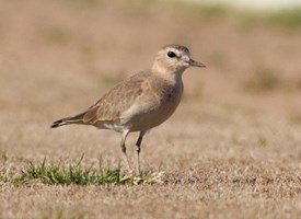
Another news story on the upcoming annual Kaval mountain plover festival. Or how a tiny farming town, fearful of federal regulation, learned to love a (not officially) threatened species.

Meanwhile, to the southeast, the lesser prairie chicken has been placed on the "threatened" list.
The prairie chicken, a type of grouse known for its colorful neck plume and stout build, has lost more than 80 percent of its traditional habitat, mostly because of human activity such as oil and gas drilling, ranching and construction of power lines and wind turbines, Ashe said. The bird, which weighs from 1 ½ to 2 pounds, has also been severely impacted by the region's ongoing drought.
Populations in Texas, Oklahoma, Kansas, Colorado and New Mexico are affected. Governors are upset. So when is the Lesser Prairie Chicken Festival?

July 20, 2013

Like Cattle, We Were Raised for Export

In a recent interview, Robert Rebein talks about his homeland — western Kansas, particularly Dodge City.

I think a couple of lessons have come [from the Dust Bowl of the 1930s]. The first lesson is that Kansas as a place is never going to be Texas or Colorado or Ohio. It’s too dry, too far from everything else, and the businesses that do best there—farming, ranching, energy exploration and production—do not require a lot of people. The other lesson is that if you do want to draw people and businesses to the state, you better try. You better understand that the lingering image of your state is a mix of the Dust Bowl, Superman, and The Wizard of Oz. If you want businesses to buy into you despite all that, you better put your best foot forward.
Here is the Vimeo trailer for Rebein's book, Dragging Wyatt Earp: A Personal History of Dodge City.

A west-Kansas blogger, Jeffro of The Poor Farm, was impressed by Rebein's book: "He has captured the essence of teenage prairie living, and in fact, life on the prairie, period, for all ages."

This passage hit him hard:
Wyatt Earp, the historical figure, really didn't make a dent in our lives. The street probably had more influence on us. But another observation Rebein makes really hit home for me:
What is it about growing up in a small town in the West that breeds such bravado, such innocence and blind faith? Was it our isolation? The vaunted self-reliance of the region? The fact that our parents and teachers praised us inordinately or that acceptance into any of the state colleges was a fait accompli? Maybe but I have another explanation:  we were leaving. And not just for a year or five years, but forever. Like the region's cattle, wheat and corn, we'd been raised for export, and most of us had learned this at about the same time we learned that Santa Claus was a fiction.  
We'd been raised for export.

It's true. Since day one, most of us knew that our parents wanted something better for us, that we were to get an education away from cattle and farming, and leave. Find a job we could love, get married and raise kids in a more forgiving climate.  

He has decided to stick it out, however. Some people do.

Not me. I go out on the prairie for hunting, for archaeological visits, or just because I must cross its expanse. Sometimes I just want to see the big sky. But I always feel a little like I am leaving a harbor in the foothills and sailing out onto the sea.

That probably comes of living as a kid on the "big island" that is the Black Hills, surrounded by wide-open country. The prairie is familiar, but it is not home.

June 03, 2013

High Plains Aquifers, Crop Changes, and the 'Secret Government'

I posted recently about the galloping depletion of the Ogallala Aquifer ("We're on the last kick," he said. "The bulk water is gone").

Chad Love explains how modern agricultural methods also make it harder for the aquifer to recharge itself: "The Ogallala is Ogaleavin' "

Here in Colorado, agriculture traditionally takes about 80 percent of the water and municipalities 20 percent, but that balance is changing as farmers sell or lease water to cities. Consequence: A shift to dryland crops, just as will probably happen on the High Plains where groundwater has been going to corn crops for ethanol, feedlots, and hog barns.

John Orr at Coyote Gulch links to a Greeley Tribune story on how winter wheat is supplanting other thirstier crops.

Back on my last newspaper job, my beat included the Southeastern Colorado Water Conservancy District. I always felt that "the water beat" was like being asked to cover the secret government — where decisions are made and court cases are fought that, years down the road, constrain what more visible government bodies can do.

Coyote Gulch is my go-to blog for secret-government news these days.

May 23, 2013

“We’re on the last kick,” he said. “The bulk water is gone.”

All my adult life, I have been hearing predictions that the Ogallala Aquifer (also called the High Plains Aquifer by people unsure how to pronounce "Ogallala"), a huge sponge of water under the High Plains, was dropping . . . dropping . . . dropping.

Fly east out of Colorado Springs and look at all the irrigated circles from center-pivot irrigation. They are growing corn, mostly.

Corn to feed to cattle in High Plains stockyards. Corn for ethanol (it's patriotic!) to make us energy independent so we won't be sending money to the Middle East.

All those wells pumping groundwater have led to this result.
Vast stretches of Texas farmland lying over the aquifer no longer support irrigation. In west-central Kansas, up to a fifth of the irrigated farmland along a 100-mile swath of the aquifer has already gone dry. In many other places, there no longer is enough water to supply farmers’ peak needs during Kansas’ scorching summers. . . . .

A shift to growing corn, a much thirstier crop than most, has only worsened matters. Driven by demand, speculation and a government mandate to produce biofuels, the price of corn has tripled since 2002, and Kansas farmers have responded by increasing the acreage of irrigated cornfields by nearly a fifth.  
From a US Geological Survey report, quoted at Coyote Gulch, the water blog:
The study shows that, since 2000, depletion of the High Plains aquifer appears to be continuing at a high rate. The depletion during the last 8 years of record (2001–2008, inclusive) is about 32 percent of the cumulative depletion in this aquifer during the entire 20th century. The annual rate of depletion during this recent period averaged about 10.2 cubic kilometers, roughly 2 percent of the volume of water in Lake Erie.
Maybe we will see more grass-fed beef (or buffalo?)  and more winter wheat in on the High Plains in the future. That's the optimistic outlook. But that slogan from the 1970s and 1980s, "A bushel of wheat for a barrel of oil!" is still just chest-thumping nonsense.

January 25, 2013

Walking the Keystone Pipeline Route

This guy sets out to walk the length of the Keystone pipeline, starting in Alberta and going south, and makes a blog of it, Pipe Dreams.

It starts here, in September 2012.

February 12, 2012

Revisiting the "Buffalo Commons"

Back in the 1980s, two New Jersey professors raised a ruckus on the High Plains by arguing that, given falling populations and the gradual depletion of the Ogallala Aquifer, the plains should be given over to some combination of parks and a different, non-irrigated agriculture including buffalo ranching, activities that would support a smaller but sustainable population—a concept known as the Buffalo Commons.

Few people wanted to hear that. Not only was it coming from New Jersey professors who by definition could not know anything about anything, but it was a slap in the face to the whole survivor mythos of the High Plains—that the people there had survived grasshopper plagues, droughts, blizzards, the Dust Bowl of the 1930s, ups and downs in commodity prices, isolation, and indeed, a gradual decline from the "good years," the first two decades of the 20th century. In general, they reacted angrily to the proposal that they "surrender."

But population was falling:
Their continuing research showed that hundreds of counties in the American West still have less than a sparse 6 persons per square mile — the density standard Frederick Jackson Turner used to declare the American Frontier closed in 1893. Many have less than 2 persons per square mile.

The frontier never came close to disappearing, and in fact has expanded in the Plains in recent years. The 1980 Census showed 388 frontier counties west of the Mississippi. The 1990 Census shows 397 counties in frontier status, and the 2000 Census showed 402. Most of this frontier expansion is in the Great Plains. Kansas actually has more land in frontier status than it did in 1890.

My personal connection: in the early 1920s, the era of prosperity, my maternal grandparents as a young couple ran a store in the High Plains town of Arriba, Colorado (pr. "AIR-a-buh"). When I saw Arriba in the 1970s, it had no business district at all except a Flying J truck stop and an antiques store. Now there is a wind farm too. My grandparents got out before the collapse, but it caught up to them elsewhere.

Meanwhile, the professors, Frank and Deborah Popper, geographer and urban planner (yes, ironic) have not given up on the Buffalo Commons idea.

At a recent conference in Salina, Kansas, Frank Popper said, "We never really expected it to have the impact it did and does. We would have recoiled then that we would still be talking about it 23 years later. It's clear that in the intervening years a quiet muscle of reality, a lot of the trends we saw in the depopulation of the Plains has continued."
"I've been accused of having a slightly un-American approach to the land and the environment, where growth is not always the be-all and end-all, where growth can go too far, and the Buffalo Commons implies a quietism or defeatism," Frank Popper said. "Instead, the Buffalo Commons implies too much growth can be a mistake, overburdening the land, overmastering the environment and in the end always getting kicked in the rear or the pocketbook--or someplace else.

"I realize there is a social comedy in two people from back east who are telling people in the Plains what to do with their land. I've enjoyed it, but there are important things to look at in how we treat this vast, characteristically American chunk of land. There are lessons here on how to live on the land that can be applied to the Corn Belt, the lower Mississippi delta, and parts of our largest cities--like Detroit--that are depopulating like the Plains. It's about sustainability. It's about being American."
 Some politicians are quietly coming around, he notes, and a Great Plains National Park "may actually happen."

November 26, 2010

The Indian Pueblo in Kansas

Foundations of "El Cuartelejo," a Pueblo Indian ruin in western Kansas
First, a timeline:
  • 1541-42 The Coronado expedition travels across the southern Great Plains. Sometimes all who wander are indeed lost—or being deliberately misled.
  • 1598 Spanish colonists led by Juan de Oñate colonize the Rio Grande valley in what is now the state of New Mexico.
  • c. 1656 A group of Indians from the Taos, N.M., area flee the Spanish and their missionaries and travel about 300 miles northeast to an "oasis" on the Great Plains, a small valley watered by a tributary of the Smokey Hill River in what is now western Kansas.This is all in the pre-horse days, which means they walked. What did they eat? What information did they have about where to go?
  • The Spanish idea of colonization was to have the Spanish noble on his plantation with his family and then the Indians to work the plantation to keep him in a very peaceful situation. Well obviously, this didn't work. Around 1656 ... somewhere around there approximately, a group of Taos pueblo Indians fled from the Spanish. .... Well, these Taos Indians fled into the plains to escape the Spanish oppression. And where they fled was to a rancheria of a Plains Apache group. (source)
  • 1680 In a rare example of cross-tribal cooperation, inhabitants of various New Mexican Indian pueblos launch a coordinated attack on Spanish colonists (particularly the priests), killing some, destroying mission churches, and chasing the remaining Spanish south into old Mexico.
  • 1692-96 New Spanish soldiers and colonists led by Diego de Vargas complete the so-called "bloodless" reconquest of New Mexico, which actually involved some hard fighting against die-hard Indian warriors. 
  • c. 1696. Some inhabitants of Picuris Pueblo near Taos also journey to the little settlement in western Kansas to escape the Spanish vengeance
  • 1697 The Pueblo Indians at El Cuartelejo are "brought home," maybe?
 A definition: The Spanish referred to the southern Great Plains as El Cuartelejo–The Far Quarter of their empire, at least on paper. The name is also applied to this particular small Indian pueblo. In its plural form, the name also referred to some of the Plains Apache people who lived there until the early 18th century.
A 1925 historic market gives a date for the pueblo that is probably too early.

(In Kansas, they sometimes spell the word El Quartelejo. They can't help it. They also call the river Ar-KAN-sas.)

All this is background. Some time ago, I heard of ruins of an Indian pueblo in western Kansas. Since we usually associate rectangular, stone-and/or-adobe buildings with the Southwest—New Mexico and Arizona—this was certainly an "outlier" in several senses.

Last Saturday I visited it, part of Scott State Park: How strange to see such a foundation in this land of cattle ranches, center-pivot irrigation, and gigantic farm machinery. There is a historical marker out on US 83 for those travelers in a hurry.

Tom Witty, former chief archaeologist for the Kansas State Historical Society, describes the site's discovery in the 1890s:
There were two naturalists ... actually, they were paleontologists from the University of Kansas—Williston and Martin And they excavated and found the remains of a small, seven-room pueblo ... just the foundations, with the floor literally covered with burned corn and artifacts. They had the pueblo, and then they discovered three major irrigation ditches. These run off of the springs that were there at that time.
[Witty describes] this rancheria as a large village complex, in which the Taos Indians built their pueblo structure and practiced horticulture in nearby garden plots, while the Apaches with whom they were associated roamed farther afield.
As mentioned, more refugees from Picuris followed those from Taos:
Tu-pa-tu, one of the principal leaders in the revolt, was a native of Picuris, and after the slaughter of all resident Spaniards, led the warriors of the pueblo to Santa Fé to take part in the siege of Otermin. The Indians not only massacred the priest, whose name was Mafias Rendon, and burned the church and surrounding buildings, but they killed every individual Spaniard living in the valleys of the vicinity. There is no record of the escape of even one to tell the tale. When the reconquest took place, quite a fraction of the population, not reconciled to renewed subjection to the Spaniards, emigrated to Cuartelejo, on the plains of western Kansas, but they gradually returned when matters became settled and their fears had subsided.
Visiting the site on a chilly, windy November day, I can attest that the small valley (or large arroyo, depending on your perspective) protects you from the gentle prairie breezes. But it must have been tough there on really severe-weather days, huddling over a fire of buffalo chips.

We have only the Spanish account for why they allowed themselves to be "retrieved." (An earlier Spanish expedition passed by on its way to disaster.)
For the moment, however, we must note the activities of Governor de Vargas, whose reconquest of New Mexico compelled him to engage in the fall of 1696 in an expedition to the east. In that year some Pueblos, obstinately refusing to accept the Spanish king and God, rebelled and fled from their homes eastward over the Taos Mountains. De Vargas, setting out at once from the Picuries Pueblo recaptured, after an exciting chase, the majority of the rebels but the rest escaped in company of some Apaches. The general’s Journal of the event does not give sufficient information to state how far he penetrated on this march. He later stated he traveled eighty-four leagues; but whether this is the distance for one or both ways is not clear. His entire journey, going and coming, however, consumed only seventeen days, two of which were spent in camp because of a blinding snowstorm. Colonel Twitchell, nevertheless, has interpreted his remark and the diary to mean that the journey took de Vargas eastward beyond Clayton, New Mexico, into the western Panhandle of present Oklahoma.

In the following year, 1697, the Reconquest of New Mexico was completed but the re-occupation of the lost province still presented serious problems to the Spaniards. Constantly on the qui vive against a new uprising, they were quick both to investigate suspicious rumors of revolt and to lend helpful hands to the Pueblo Indians. In this latter spirit the governor despatched in 1706 an expedition to the far off Cuartelejos to bring back the fugitives who escaped De Vargas in 1696, and others there enslaved, and who now sought the privilege of returning to their kinsmen. The expedition, commanded by Captain Juan de Uribarri, journeyed through the Jicarilla country of Northeastern New Mexico, the Carlana country south of the Arkansas and then eastward from near present day Pueblo, Colorado, to the Cuartelejos in Eastern Colorado of to-day. These savages received the expedition with genuine expressions of friendship, offered no objection to the loss of their slaves and servants but loaded the Pueblo ponies high with corn and sent off Spaniards and Indians rejoicing.

Enslaved? So the Spanish were doing them a favor? You have to wonder. Poor, grateful savages. Or, perhaps, some Picuris people were indeed enslaved by the nomadic tribes, separate from those living at El Cuartelejo settlement. Who knows? Other accounts give a different reason for abandoning the settlement:

By the 1730s raids by Comanche, Ute, and Pawnee had decimated the Cuartelejo Apache. The survivors moved south to join the Jicarilla Apache at Pecos. However, after 1763 and the French retreat from the area, the pueblo was abandoned. Its walls decayed and the structure was buried by drifting soil.
And that was the story until American scientists re-discovered it in what was now called the state of Kansas.